
Fellow Legends Patrol Member (and my younger brother) Cory "Will"(or "Gimp") Willits and I recently completed a 3 day hike of sections 1 and 2 of the Ozark Highlands Trail. I will separate the sections into 2 posts, but will tell the story in continual form. The planning for this trip was started several months ago. Cory is enlisted in the USAF and is currently stationed in Honduras, so needed to take leave in order for us to complete the hike. We planned on hitting the trail by noon on Sunday the 28th of November.
Our shuttling plans didn't work out, so the backup followed us to Cherry Bend on Hwy 23(end of section 2) to drop our recovery vehicle. We piled into his 4WD truck for 40 miles of gravel roads westward to Lake Ft. Smith State Park, the Western Terminus of the OHT. It's funny now, but I had initially thought that taking the gravel shortcuts would save time. With the old man driving 2 of his sons, it evolved into a sightseeing trip quickly. But who complains about quality time with their brother and Dad? We arrived at Lake Ft. Smith about 4pm, and were on the trail within minutes. Let me give some advice here. In your haste to catch up to your time frame, NEVER just grab your pack and roll out! One of my Nalgenes had dislodged from the side pocket of my pack and was left behind in the truck bed. Fortunately, it was my third bottle, and we were able to make do with Cory's 3 and my 2 for the trip.
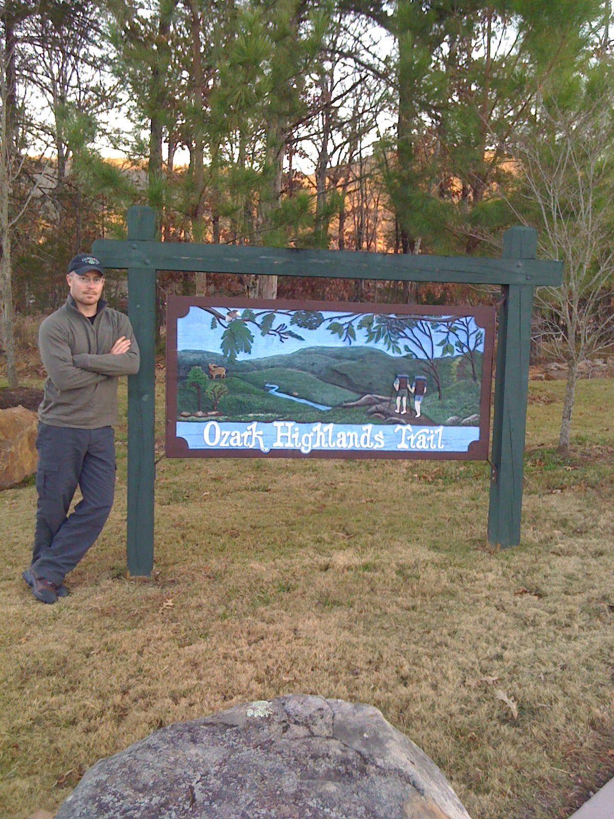 |
| Cory at the trailhead |
The trail starts on the North side of the main building at Lake Ft. Smith down the sidewalk towards the visible lake. There is a very large sign(pictured above) hanging at the trailhead. It's almost as if the park is proud of their status as the beginning of the trail. 100 yards down the sidewalk, the trail heads North, along the Western side of the lake. The reason I point this out is that since the last time I hiked this section(15 years ago), they have had major construction within the park. Lake Ft. Smith got a new dam and now incorporates the old Lake Shepard Springs into it. So, instead of the trail going around the lake to the South, it now goes to the north. The trail is very well marked with white flashes, but after mile marker 1, you won't see another for at least 6 miles. We only had about an hour until dark, so we dropped pack about 1.3-1.5 miles into the trail. I'm sure this is a no-no, but we stealth camped near one of the old homestead rock chimneys, within sight of the lake. The temperature dropped down to about the freezing mark overnight, and we had some 10+ m.p.h. winds. We weren't sweaty yet, so it was a warm enough start.
We were up before dawn and broke camp with a breakfast bar in hand by about 7a.m. Within minutes, we felt the first drops of rain. Yuck. We proceeded at a good pace. At the North end of the lake we filled our canteens and had a "foot wet" crossing at Frog Bayou. It was at fairly low depth and speed, but I imagine this would be exciting at higher water. Onward we went, and it continued to rain. I also want to point out that from Frog Bayou until we left the park (about 3 miles), the usual white 2"X4" flashes seem to have been abandoned in favor of round ones with a white arrow. Just an FYI, as they are still very easy to follow. The trail curved back South and stayed within sight of the lake pretty much until mile 6 or so, then meets up with the old trail and heads up the Jack Creek drainage. So far the trail had been mostly flat, with elevation gains of no more than 75 feet from lake level(elev. 1000).
For the next 4+ miles, the trail will stay within the Jack Creek "hollow" while climbing about 600 feet or so. There is a handful of "boot dry" crossings within this section, but somehow, my boots weren't dry anyway. We crossed Old Locke Road at Dockery's Gap (elev 1600ft, mile10.4), then began a steep descent to Hurricane Creek, dropping nearly 500ft within 3/4 of a mile(with some switchbacks). This is probably nearly always a wet foot crossing, but with the careful use of my trekking poles, we risked it and crossed boots-dry. I can see why they call it Hurricane Creek. In high water, a hiker might consider heading a half mile or so upstream to use the road bridge. Pretty, though. We stopped and had lunch(Enertia Trail Foods) by the creek, and refilled our water. There is no reliable water between this point and White Rock Mountain, and we were planning on setting up camp long before that. From there, you begin a 800ft + climb over the next 3 miles. About 1.5 miles after the creek we came to a gas pipeline(buried), and stopped and had a rest on a downed tree. I was about tuckered out. Feeling lightheaded and nauseous. For real, us old guys need to digest a bit after lunch if we're going to hike uphill like that.
It was about 2pm, and we had covered 11 miles already, with dense fog to our South(blocking some great views), and a steady drizzle still falling. It was about 40-45 degrees, and we were soaked. I sat on that log for at least 20 minutes before Cory said we either needed to make a fire and setup camp or press on to White Rock in hopes of scoring a cabin for the night. We sucked it up and headed up the trail. I guess that was where I hit the wall that day. In the next 2.5 hours, we progressed the rest of the way up the climb towards our new goal. At about mile 14, we crossed the first of 2 forest roads and the trail had for the most part leveled off around 2000ft elev. This area seems to have been cleared out by a controlled burn within the last several years, because it is clear of most undergrowth except thorns. I have to say that there were some very tempting campgrounds that we passed by.
After the second forest road, we entered the only section of the trail we didn't like. the thorns were much more prevalent and there were many trees laying across the trail. I hate to complain about it, because I have yet to volunteer for trail maintenance, but this section needs it. On a map, the area is identified as McMinn Gap, and it runs from roughly mile 14.2 to mile 16 or so. Also, I noticed that the entire trail through there runs kind of off-camber, making me feel like one leg is too long. We crossed the third forest road at mile 16.2 and headed up towards White Rock Mountain. After crossing this road, the trail goes up a bit, then down a bit, then up a bit, and when it goes down again, we found ourself cursing the trailblazing Gods since we could see the bluffs of White Rock coming up. "Why must we go back downhill? Bah!" But, with the prospect of a warm fire in our immediate future, we trudged on.
The trail takes you by a spur trail that leads to Shores Lake and also one that makes a loop around the plateau. Then you are at the eastern end of the bluff for the walkup. It's steep, but not too bad. Up we went and came upon the trailhead parking and cabins on top of the mountain(elev 2200, mile18.7). We made a beeline to the custodian's house only to find that there was nobody home. We bought some candy bars($1 each X4) from her honor system refrigerators, and settled in to wait, hoping for her swift return. We were disappointed when she didn't make it after 1.5 hours waiting. We walked over to the campsite and began building a fire(and had a decent one started) before she arrived to save the day!
We had just enough cash on us for the rental($70), so we got settled in very quickly, with a roaring fire going inside the woodstove within minutes. All of our wet gear was hanging on the woodbox, chairs, and anything we could find to get them dried out before morning. Before we went to sleep, the fog lifted and we could see the sky for the first time all day. Our day was complete, after hiking 17 miles that day, in about 8 hours of trail time. Not bad.
So, what we learned in section 1 of the OHT is:
1. Always have at least $74 cash on you
2. There's no shame in renting a cabin in hypothermic conditions
3. Be nice to Miss Paula at White Rock Mountain
4. Don't start the trail with more than 1 liter of water. Instead, refill before leaving sight of the lake.
Forestry Service pamphlet for the OHT
Paragraph separations please!!!! It will make it so much easier to read!
ReplyDeleteSo Dad dropped you off and picked you up? I kinda missed that.
ReplyDelete